Tag: map

Time to Evacuate

Share
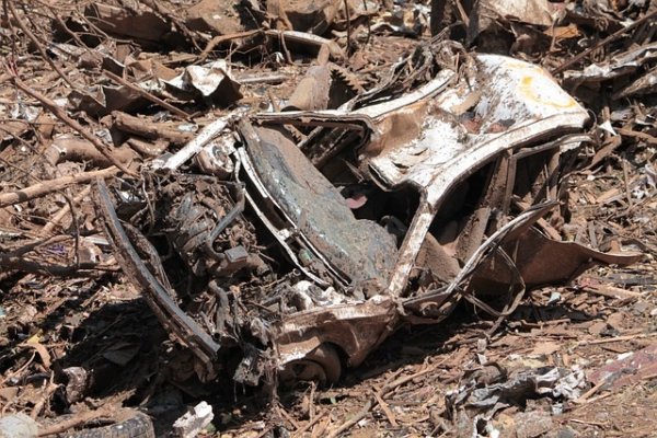
Flooded car with debris
What good did it do for the Bahamians to be prepared for emergencies?

Here at Emergency Plan Guide we don’t really focus too much on being prepared for when it’s time to evacuate. Rather, we spend most of our time and energy investigating ways to prepare for and to shelter in place after a disaster. For example . . .

  • Last week we talked about ways to store water, particularly if you have advance notice.
  • Several times over the summer we talked about being ready for power outages, including using solar technology as an alternate source.
  • And of course the July 5th earthquake generated a couple of Advisories about what might happen in the aftermath of a bigger one.

And then, two weeks ago, Hurricane Dorian hit the Bahamas.

And we witnessed images like the one above, only far more vast in scale and far more dramatic. I have to assume you asked yourself the same question I asked myself:

What good did a stash of emergency supplies of water and canned beans do for these people, whose homes were leveled?

The inescapable truth is that some disasters are so terrible, so violent, that just coming out alive is all you can hope for.

Still, Hurricane Dorian both in the Bahamas and in the U.S. reminded me about other aspects of preparedness that we may not think about often enough. Have you considered them in YOUR planning?

There is a time to evacuate.

Many of the residents of the Bahamas did not evacuate, even in the face of the predictions. Why not? Here are some of the comments I culled from news reports.

  • Bahamians are “used to riding out storms.”
  • By the time people realized the storm was a category 5, it was too late to do anything.
  • The government issued watches and warnings but did not issue a mandatory evacuation order.

Dorian moved from the Bahamas to the east coast of the U.S. Over a million people followed recommendations to evacuate, but others in the U.S. did not evacuate, either. Why not?

  • Some people were losing work because everything had already been shut down. They couldn’t afford the expense of evacuating.
  • Some had no means of transportation.
  • Others thought their homes could withstand the storm.

So here are evacuation questions for you, your household and your neighbors.

(1) Are you aware? Are you prepared with battery or solar-operated radios so you know the status of approaching storms, even when the power is out? There’s no good excuse for not knowing what’s coming. And, of course, is your car always half-full of fuel?

(2) Do you agree there may be a time to evacuate? Are you agreed that at some point it will be time to evacuate – and have you figured out who will make the call?  Or are some people in your household unwilling to leave, for whatever reason? (Pretty tough to leave some people behind!)

(3) What route will you take? Do you know HOW to evacuate? That is, what roads you can take and which to avoid? What bridges are likely to be out?

We’ve talked before about having a map of your community and area so that you can find alternate routes when main routes are blocked. Of course, heading off through an unknown neighborhood could put you in danger of flooded roads, etc. Again, stay tuned to official channels to know which routes are being monitored.

It’s possible, of course, that you will have only one route, and in an emergency it could look like this . . .

“Massive traffic jams as people flee storm . . .”

(4) Do you need to plan to leave early? If you live in one of the U.S. cities that has limited evacuation routes, your plan must include leaving well BEFORE the order is called. Here’s an article that actually lists the worst cities for evacuating ! (Click the link within the article to see the full listing of the 100 evacuation-challenged cities.)

(5) Do you have money? Finally, do you have money set aside to allow you to evacuate? You will need to pay for gas, for food and lodging and perhaps other supplies. It could easily add up to hundreds of dollars a day until you get to where you’re going, even if it’s to out of town relatives. And then, you’ll have to come back.

We’re working on a more detailed look at the financial aspect of emergency preparedness. In the meanwhile, if you live in areas that could be threatened by natural disasters like storms, fires or hurricanes that would force you to evacuate, consider stashing some cash in your survival kit (along with important ID and/or travel documents).

Hurricane Dorian was an historic category 5 storm. But any hurricane or rain storm or approaching fire could require you to make a decision to evacuate. Are you really ready?

Virginia
Your Emergency Plan Guide team


Can you read a map?

Share

In the old days everyone could read a map.

When I was a kid, we used to pile into the car for a long Sunday drive. (Gas was cheap!) Part of the fun was discovering roads we’d never traveled before.

We used folded paper maps to figure out where we were headed. There was always a box full of them – road maps, topographical maps, occasionally forestry or fire road maps. Most showed the effect of having been folded wrong at least once in the past!

The job of reading the map fell to one of the kids.

Today, of course, nobody reads a map.

Oh yes, we pull up maps on our phone – and then we listen to directions!

In an emergency, when phones are down and batteries are dead, you and your children may find yourselves having to take a road you’ve never traveled before. And to do that safely, you are going to want to be able to read a map.

There are a few basics to reading any map:

  • orienting your map to the points of the compass
  • understanding the scale of the map, and
  • figuring out what the various symbols mean.

Of course, you have to figure out where you are on the map in order to get started!

Give your child the chance to learn this skill!

ow much help you or your child will need to understand a map will depend on a whole host of things. Here’s a great teaching video that nearly everyone will find useful. (It includes drawing your own map you can use for your Family Evacuation Plan.)

Plan to stop the video from time to time to discuss!

And if you want to get more deeply into the whole thing – and your kids are old enough – you may want to add one or more compasses to the exercise, to make it even more fun.

This is an official “Boy Scout” model with lanyard that would make a great, inexpensive gift to go with the map reading. (Click on the image to see details on Amazon.)

This could be a fun activity for your whole family, and give the older members a chance to show off . . .!

Virginia
Your Emergency Plan Guide team

Day 8 of Summer Vacation: A time for some shorter and lighter Advisories as a welcome change-of-pace!

Trapped In The Car

Share

Cars in flooded street

Trying to escape!

How many stories have you heard in just the past few hours about people trapped in their cars due to severe weather? I’ve heard about hundreds, even thousands, of people — racing to avoid an oncoming hurricane, carried off roads by flood water, or just stuck for hours in massive traffic jams!

If you find yourself in one of those traffic jams . . .

and you are unable to escape before the storm hits, or unable to get home after the storm hits, what condition will you be in?

  • Do you know what action you and your family members in the car should take, and when?
  • What about being in touch with other family members that are outside the car?
  • What supplies will you have in the car to help you make it through the hours until you can get back home or to another safe place?

What can you do now, before the next storm hits?

Here are some very basic preparedness actions that the recent storms have reminded us about. You can take these steps NOW before the next storm hits!

1. Keep the car at least half full of gas at all times.

2. Have a map of the area in case you need to find alternate routes to get around traffic jams, road blockages, etc.

3. Know which radio channels broadcast weather information. On CNN we heard weather broadcasters telling people exactly what to expect by the minute.

4. If you get in your car, take your Survival Kit with you. Knowing you have some food, some water, some sanitary supplies, and some cash will be reassuring, at the very least. If you have to manage in the car for many hours, having this Kit will be a huge comfort.

5. If you take your pet in the car, take the Pet Survival Kit, too. I saw one man in flip-flops and a t-shirt whose passenger was his dog. Did the dog have food and water? An adult can understand that doing without is necessary for a while; an animal – or a small child – cannot.

Flooding facts, for review – thanks to FEMA.

More people drown in their cars than anywhere else.

Know the difference between a WATCH and a WARNING. A flood watch means a flood is possible in your area. A flood warning means flooding is already occurring or will occur soon in your area.

Six inches of water will reach the bottom of most passenger cars causing loss of control and possible stalling. A foot of water will float many vehicles. What looks like six inches may not be; the road may be washed out below the water surface.

Two feet of rushing water can carry away most vehicles including sport utility vehicles (SUV’s) and pick-ups.

Stay in the car or get out?

Do not drive into flooded areas. But if floodwaters rise around your car, abandon the car and move to higher ground if you can do so safely. Do not stay in the car: it may stall or get stuck in the water, and then get pushed off the road. Once off the road, cars often start to roll, making escape impossible.

What’s your story?

What experiences have you had being trapped in a car? Share your stories with us and our readers. It may help save lives.

Thanks, Virginia

P.S.  If this article strikes a chord, please pass it along to friends and family.  Just copy this link and send it in an email:

https://emergencyplanguide.org/trapped-in-the-car/


Are you in a flood zone?

Share

Like maps?

If you are a map fan, check out FEMA’s Map Service Center to see whether you’re in a flood zone. The map is designed for ordinary citizens, but also for real estate and insurance specialists, who can create printouts coordinated with the Digital Flood Insurance Rate Map.

Starting in May, 2013, the map service is being expanded and upgraded. But in the meanwhile, you can do what I did to check out your own home and community. It’s easy!

Check FEMA’s map service.

Here’s the link. www.msc.fema.gov.

Do a “Product Search” by filling in your address. A second screen will come up identifying your general area (county). Click on “View” and be patient as the data loads. Ultimately, you’ll be rewarded with a very small map of your area!

FEMA map shows flood zones

Red arrows point to flood zone markings

You can adjust the scale at the top of the screen. (I changed the 4% to 15 % and that gave me a much better size map, and I could read most of the street names.) You can also click on the “pan” button on the left (looks like a little hand) and move the map around. (Again, be patient since it’s a lot of data and the map re-adjusts slowly.)

Once you’ve found the right area and the right level of detail, search for overlays. In our example, the gray dotted area (left arrow in the illustration) indicates a 500-year-flood zone, and the bright blue color (right arrow in the illustration) indicates a 100-year-flood zone, which means there’s a 1 percent chance of a 1-foot or higher flood in that area in any given year.

How would you be affected?

In the illustration, our home is not in the flood zone. But the blue area happens to be a key highway/railroad overpass/underpass. This interchange is about one mile from our neighborhood, so a flood there would definitely impact our emergency response, particularly if an evacuation were called for.

Check out this resource for your neighborhood, and also for your business or place of work. It’s interesting and good information to have.

Virginia
Your Emergency Plan Guide Team

We’ve added more information about flood insurance. Check it out here.